GeoData
GeoData is a local data source and editor for the GeoJSON format that enables importing and editing GIS data. This data can be used by maps on video wall as GeoJSON layer.
Note: This is a data source, not a visualization tool. Therefore, the style, center, or view settings of the map are temporary and only relevant for the editor. These settings are not utilized by visualizations that use this data source.
Importing and Editing GIS Data
You can import or export GIS files in GeoJSON and KML formats. Alternatively, you can create a blank map and add elements using the map or the JSON editor located on the right side of the interface.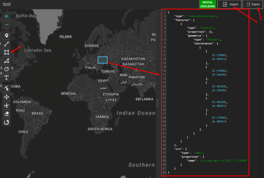
Adding and Editing Layers
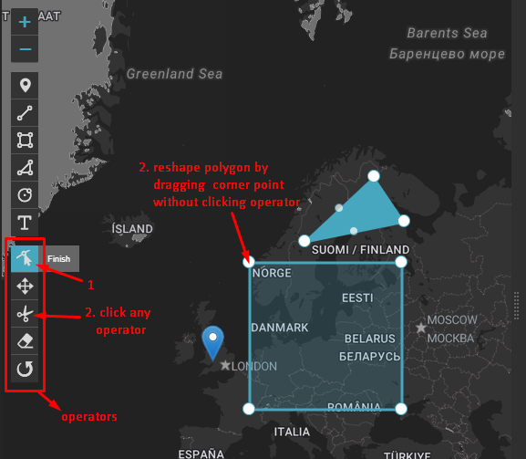
Using the left menu in the map editor, you can add or edit layers such as markers, polygons, polylines, etc. Additionally, you can zoom in or out and set a default center view for the map.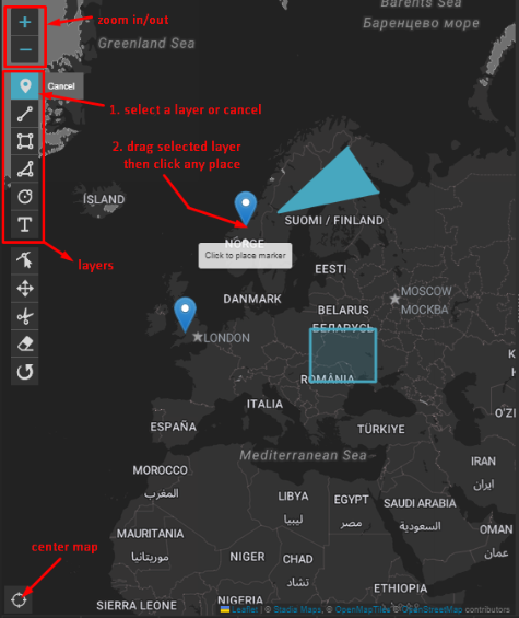
Layer Tools
After clicking the Edit Layers button, you can perform the following actions:
- Cut layers
- Drag layers
- Remove layers
- Rotate layers
Dynamic Map and JSON Interaction
As you edit the map, the JSON data on the right updates in real-time to reflect your changes. Similarly, you can directly edit the JSON data, which will immediately affect the corresponding layers on the map.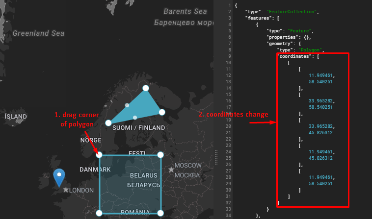
JSON Editing
When you input values in the JSON editor, the positions or properties of layers on the map are updated instantly.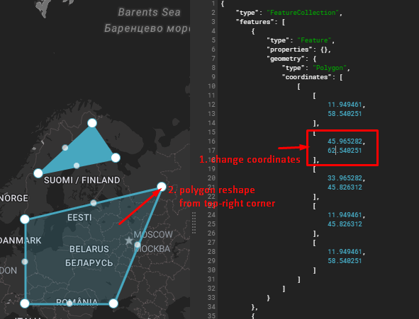
Supported Formats
This data source only supports spatial data in the GeoJSON format. For more details, please refer to the DataFormat documentation.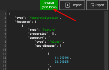
Adding Properties to Map Elements
To add data values to map elements, ensure that the features in your GeoJSON data include properties. For example:
{
	"type": "Feature",
	"properties": {
		"value1": 4.2,
		"value2": 5.3
	},
	"geometry": {
		"type": "Point",
		"coordinates": [20.288429, 43.293783]
	}
}
The data you import, whether in GeoJSON or KML format, may already include properties for features. If not, you can manually add them through the JSON editor. These values can later be utilized in visualizations and maps via dataset settings.